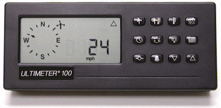
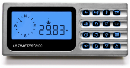
Compatible with
ULTIMETER 2100/800/100 from June 2005 forward,
WeatherText® Tools is a software
package for Windows operating systems which enhances the capabilities of
WeatherText®. Send email weather
reports, log weather data, post weather data to a web page, and generate an
APRS format weather report. Data Logger Kit includes 15-ft. PC Interface
Cable (for DB9 Serial COM Port). Get maximum benefit from your
ULTIMETER Weather Station with WeatherText®!
WeatherText® Tools
is a Windows PC application which enhances
the capabilities of WeatherText®:
WeatherText
® Data
Logger: a
data acquisition tool which generates and archives log files of weather data in
two convenient file formats: .txt (for
convenient viewing using word processor or IE) and .csv (for instant
analysis, charting, and graphing on Microsoft
Excel or other spreadsheet
program)
WeatherText
® Internet: an FTP utility which transfers the WeatherText™ reports to a web
server at scheduled intervals (in both .txt and
.csv file formats).
WeatherText
® Mail: an email application which automatically sends
WeatherText® reports to selected email
addresses at scheduled intervals. Share
critical weather data from your ULTIMETER with personal contacts, weather bureau, or Emergency Management
Agency.
WeatherText
® APRS: a tool which automatically generates a weather report, properly
formatted to be transmitted via APRS (Automatic
Position Reporting System), an amateur radio technology developed for
efficient transmission of data packets.
Requires use of UI-View32 software or compatible equivalent.
Each
WeatherText®
One-Minute Report
includes
all current values, plus the highest wind speed over the past
minute with the associated wind direction, the
average wind speed over the last minute, the 3-hour barometric
pressure change, today's and long-term
rainfall, today's highs and lows, and current time and date. In addition,
each time a key combo is pressed, a
comprehensive WeatherText® Complete History Report is output (contains highs and lows for the previous 7 days plus long-
term).
Following is a sample of the
WeatherText®
One-Minute
Report:
ULTIMETER WEATHER REPORT
01/17/05 09:32A
Wind: Cur 8.0MPH 180Deg, 1mAvg
4.6MPH, 1mPeak 9.8MPH 176Deg
Hi 9.9MPH
188Deg
WChill: Cur 75.7F, Lo
75.6F
Temp Out: Cur 75.7F, Hi 75.7F,
Lo 75.6F
Temp In: Cur 76.4F, Hi 76.6F, Lo
76.3F
Hum Out: Cur 65.6%, Hi 65.9%, Lo
65.6%
Baro: Cur 29.93inHg, Hi
29.94inHg, Lo 29.93inHg, 3hr chg +0.0inHg
Dewpt: Cur
63.6F
Heatx: Cur
77.0F
Rain: Today 0.21in, Since
01/01/05: 2.57in
Following is a sample
of the WeatherText® Complete History
Report:
ULTIMETER COMPLETE HISTORY
REPORT
Wind Hi Lo
Chill
02/07/05 7.4MPH 68Deg 06:43A,
48.1F 02:19A
02/06/04 11.4MPH 193Deg 12:15P,
47.9F 04:37A
02/05/04 13.4MPH 24Deg 09:13A,
46.9F 08:17P
02/04/04 12.9MPH 184Deg 01:08P,
46.1F 07:48P
02/03/04 8.8MPH 205Deg 10:14A,
40.8F 09:28A
02/02/04 11.3MPH 210Deg 02:48P,
42.7F 11:23A
02/01/04 8.5MPH 69Deg 11:24A,
41.5F 08:18P
01/31/04 13.4MPH 210Deg 02:31P,
41.1F 07:44P
Long Trm 20.4MPH 77Deg 01/27/05
05:22A
Long Trm Lo Chill 30.1F 01/27/05
02:15P
Temp Out Hi Out Lo In Hi In
Lo
02/07/05 59.5F 05:43A, 48.1F
02:19A, 76.0F 12:34P, 66.8F 03:45A
02/06/04 58.9F 07:01A, 47.9F
04:37A, 74.7F 12:00A, 67.4F 05:58A
02/05/04 62.8F 01:55P, 46.9F
08:17P, 77.4F 04:42P, 65.6F 06:06A
02/04/04 60.5F 05:20P, 46.1F
07:48P, 78.2F 01:56P, 65.3F 05:09A
02/03/04 60.7F 07:11P, 40.8F
09:28A, 78.0F 05:52P, 64.8F 04:40A
02/02/04 58.1F 09:16P, 43.4F
12:57A, 79.4F 02:41P, 64.3F 05:08A
02/01/04 53.8F 05:23A, 41.5F
08:18P, 78.2F 02:18P, 64.3F 04:28A
01/31/04 54.7F 06:26A, 41.1F
07:44P, 80.4F 03:20P, 65.6F 05:12A
Long trm Out Hi 62.8F 02/05/05
01:55P, Lo 30.3F 01/28/05 08:44P
Long trm In Hi 80.4F 01/31/05
01:55P, Lo 63.6F 01/28/05 05:10A
Humidity Out Hi Out Lo In Hi In
Lo
02/07/05 97.2% 12:00A, 45.7%
02:34P, 28.7% 05:51A, 25.2% 02:58P
02/06/04 98.1% 05:09A, 56.5%
02:27P, 35.6% 06:20A, 32.4% 02:45P
02/05/04 92.9% 12:00A, 45.8%
02:10P, 29.1% 06:43A, 26.0% 02:49P
02/04/04 100.0% 12:00A, 85.7%
04:49P, 58.2% 05:39A, 47.1% 05:10P
02/03/04 100.0% 11:37P, 86.0%
12:33P, 58.8% 05:21A, 45.9% 02:32P
02/02/04 96.3% 12:27A, 52.3%
01:57P, 37.3% 05:31A, 30.7% 02:21P
02/01/04 94.2% 12:00A, 45.7%
03:51P, 28.9% 04:59A, 25.8% 04:07P
01/31/04 97.8% 08:51P, 65.4%
03:51P, 42.3% 05:52A, 34.1% 04:19P
Long trm Out Hi 100.0% 01/26/05
12:33A, Lo 39.1% 01/29/05 02:05P
Long trm In Hi 71.1% 01/14/05
06:32A, Lo 21.0% 01/19/05 05:47P
Barometer Hi
Lo
02/07/05 30.47inHg 12:00A,
30.23inHg 03:14P
02/06/04 30.57inHg 10:17A,
30.41inHg 12:45A
02/05/04 30.41inHg 11:37P,
30.19inHg 12:01A
02/04/04 30.19inHg 10:03P,
30.11inHg 01:21P
02/03/04 30.40inHg 12:00A,
30.13inHg 05:08P
02/02/04 30.50inHg 09:32A,
30.40inHg 09:49P
02/01/04 30.46inHg 08:48P,
30.37inHg 03:18P
01/31/04 30.38inHg 11:51P,
30.13inHg 12:00A
Long trm Hi 30.77inHg 01/28/05
09:51A, Lo 29.57inHg 01/26/05 01:39P
Rain
02/07/05
0.00in
02/06/04
0.00in
02/05/04
0.00in
02/04/04
0.34in
02/03 04
0.02in
02/02/04
0.00in
02/01/04
0.00in
01/31/04
0.00in
Long trm Since 01/01/05
0.60in


